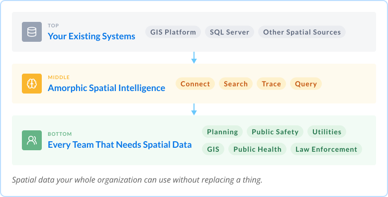
Your GIS investment, extended.
Add natural language search, automated data lineage, and AI-powered spatial querying to the GIS environment you already run. No system replacement.
No disruption.
Spatial data drives nearly every city and county
operation. Getting to it without a GIS specialist
is another matter.
GIS data only specialists know how to find
No way to ask spatial questions without writing queries
Data lineage rebuilt manually on every project
Spatial data siloed from every other enterprise system
AI workflows blocked by data no one can access
GIS team capacity spent on discovery, not development
Amorphic Spatial Intelligence is a single intelligence layer that sits on top of your existing GIS environment. GIS teams keep their platform. Every other department gains the ability to find, understand, and query the spatial data it holds.
Four capabilities that work in sequence — connect the data, find it, understand it, query it.
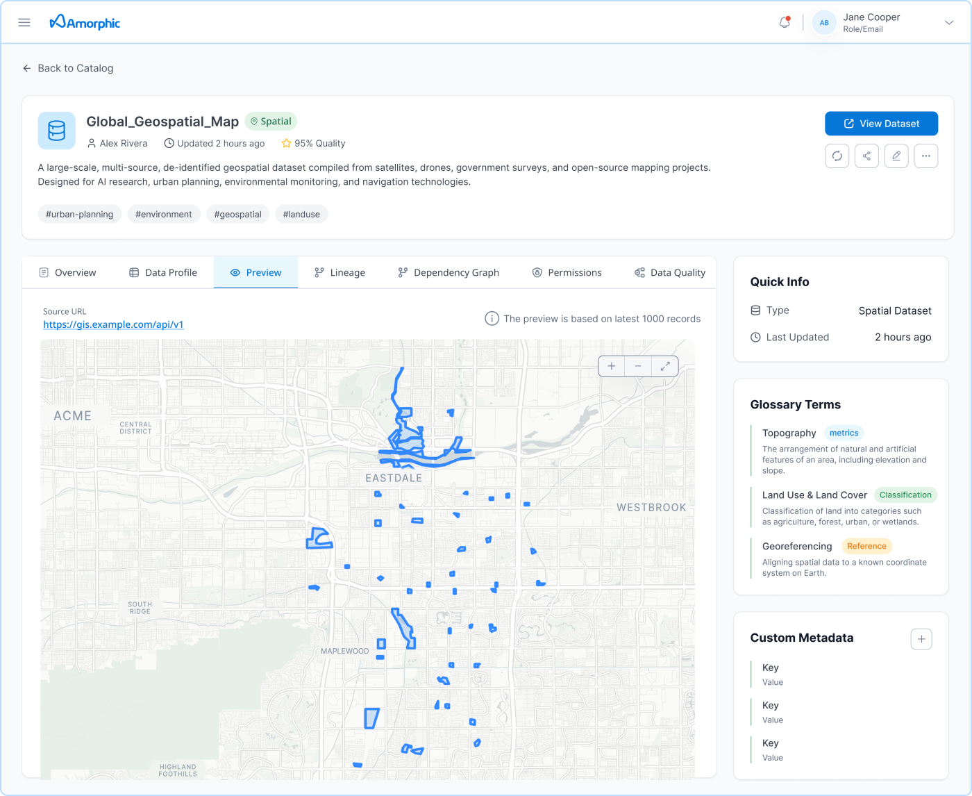
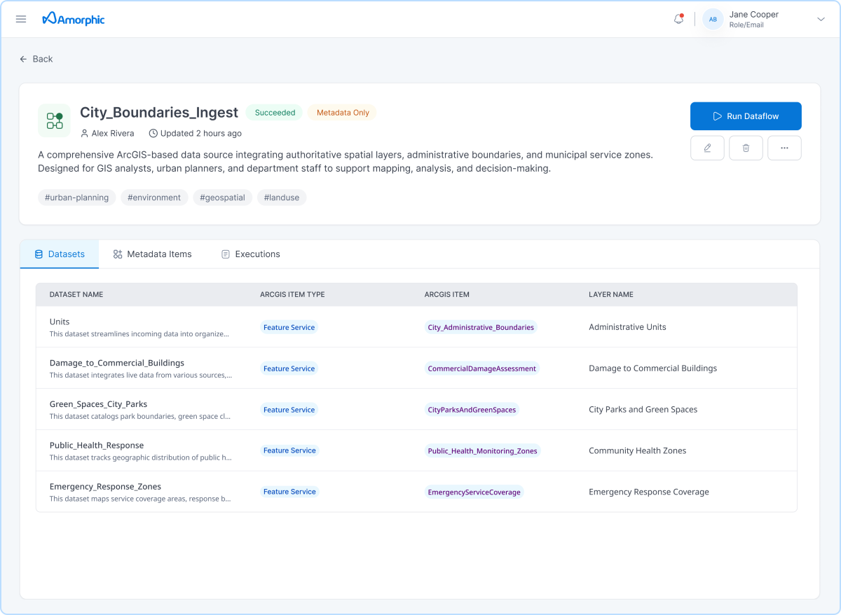
Amorphic connects to your GIS platform via standard APIs, ingesting datasets, metadata, and item relationships. SQL Server geodatabases are also supported.
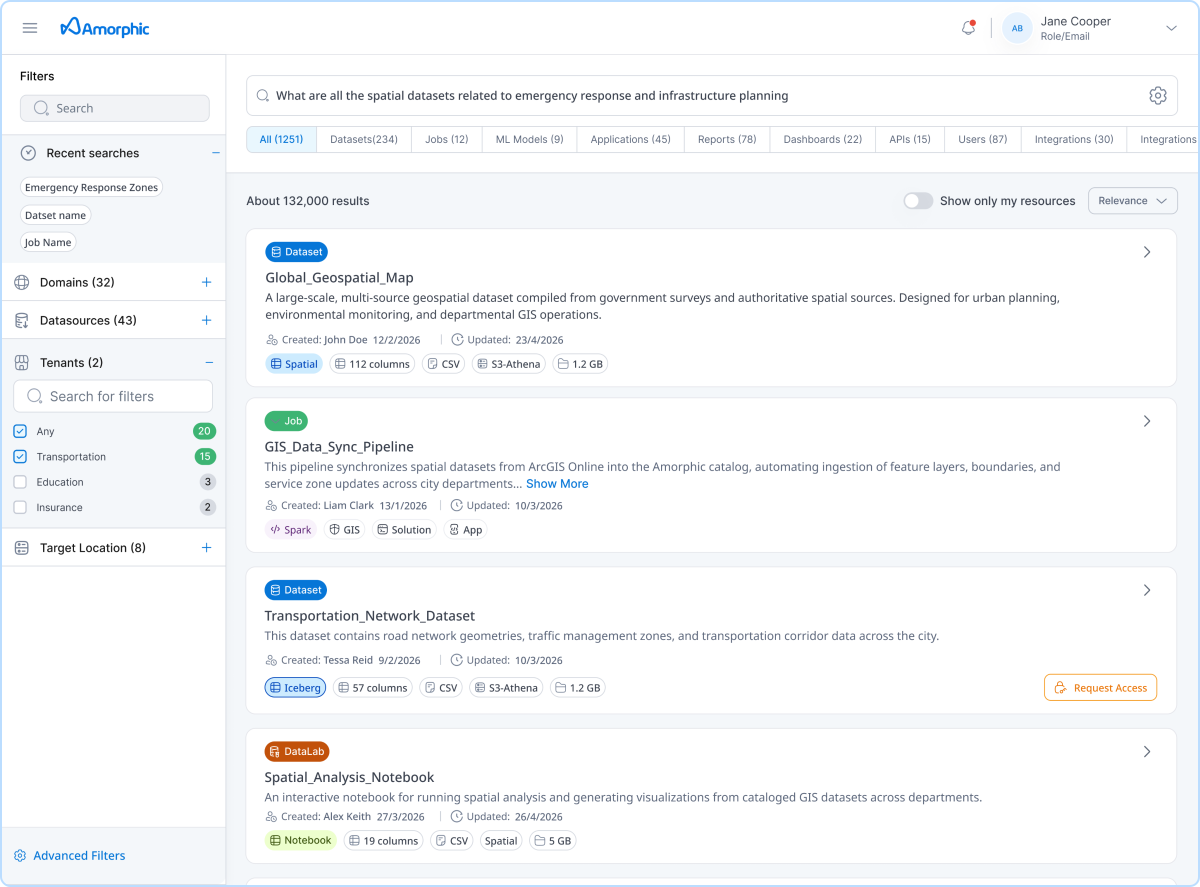
Staff type a plain-language question and receive relevant datasets with metadata and an embedded map preview. No exact dataset name required.
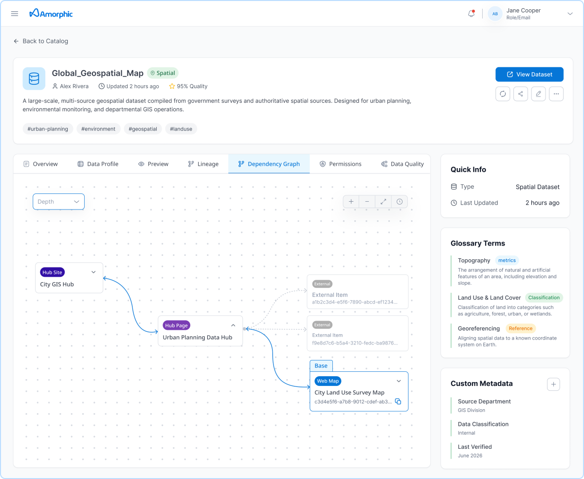
Amorphic maps the full item hierarchy on ingestion: Feature Layers through Feature Services, Dashboards, Hub Pages, and Hub Site Applications. Items not yet ingested appear as grayed-out nodes, giving teams full ecosystem visibility from the start.
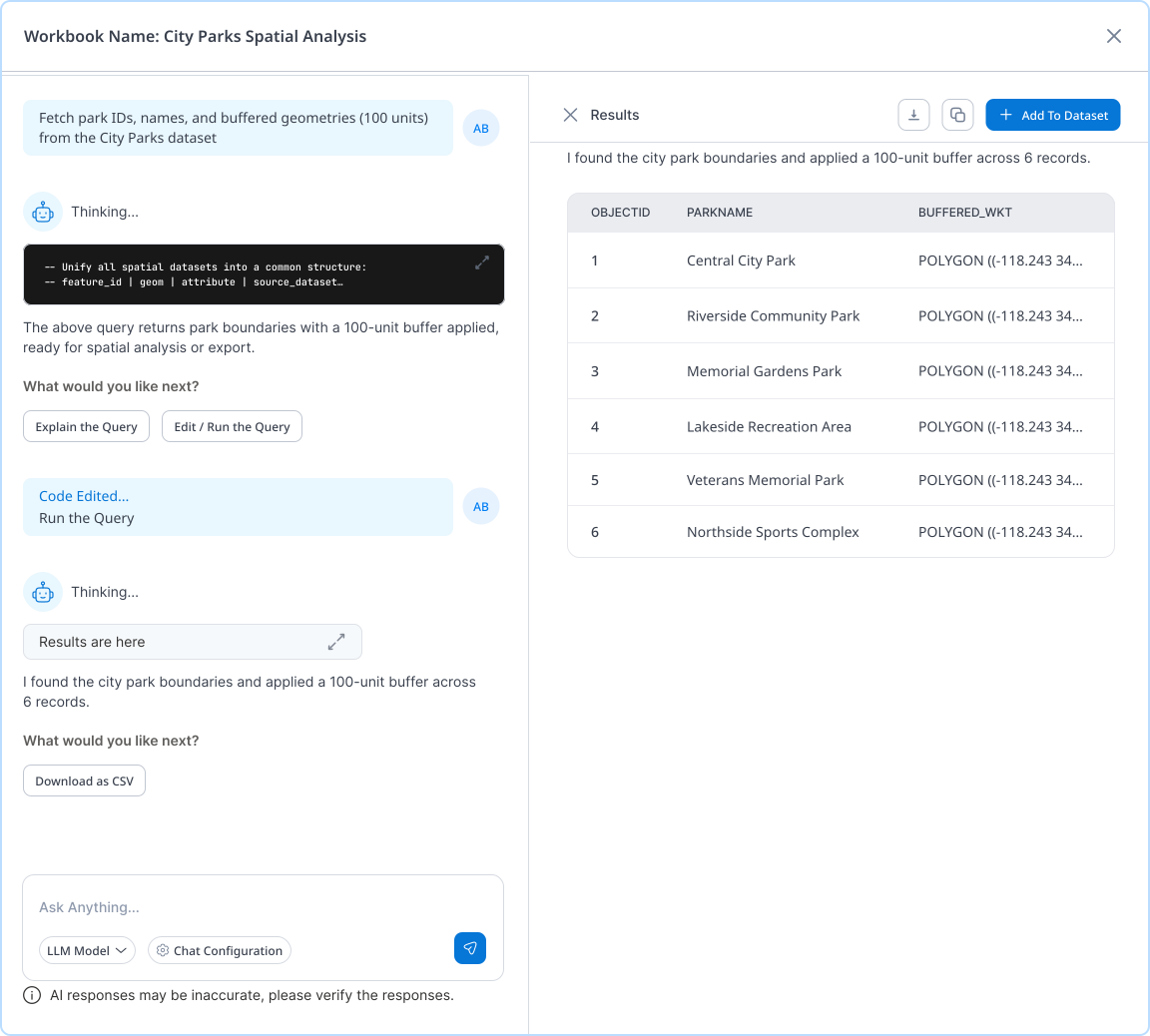
Analysts type the question they actually have and the system builds and executes the spatial query automatically. Results are viewable in the platform, saveable as new datasets, or routable to PowerBI or QuickSight.
One searchable catalog for all spatial data so specialists spend time building, not fielding discovery requests.
Query incident coverage, resource locations, and response area gaps in plain language, in minutes.
Map incident clusters, query EMS call density by zone, and track geographic trends without specialist involvement.
Combine GIS data with permit records and run spatial queries to understand land use, infrastructure, and development patterns.
Connect spatial infrastructure records with work order systems and query the combined data to identify gaps and prioritize maintenance.
Surface crime density patterns and query incident data by geographic area without routing every request through an analyst.
Process and analyze spatial data internally, then use those outputs to power resident-facing portals for permits, service requests, and public infrastructure.
Any staff member can find, preview, and query spatial data independently — no specialist required.
Automated lineage replaces manual dependency investigation. Developers see the full source chain the moment they open a dataset.
Departments get answers directly. GIS team time shifts from responding to requests to building with data.
Organizations that deploy Amorphic for GIS consistently expand it to connect police, fire, HR, and permitting data alongside it.
One environment where ArcGIS data, lineage, and enterprise sources are all connected. No manual dependency discovery. Shorter development cycles.
Amorphic connects via API and keeps every existing system in place. The GIS investment is extended, not retired.
Have questions or want to see Amorphic Spatial Intelligence in action?
Let’s connect.
Download the solution brief to see
the full capability set.